 fire closure area 9/12 |
from various sources
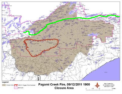
The Kekeabic Trail has now been closed, as has a large portion of the Boundary Waters Canoe Area Wilderness. For a much larger map with more detail, see the Closure Area Map from the Minnesota Incident Command. This is a pdf.
In the map above, the red outline is the fire perimeter as of Monday evening. The shaded area is the portion of the BWCAW that is closed. The green line is the NCT/Kekekabic Trail.


No comments:
Post a Comment