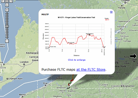
 example of an elevation profile |
from the Finger Lakes Trail Conference
An interactive map for the whole Finger Lakes Trail system of ~950 miles is now online at www.fingerlakestrail.org.
You can zoom in and pan the map. Zooming in twice shows waypoints for trailhead parking, shelters, campsites (including primitive), and hunting closures (red flag waypoints). Clicking on a waypoint brings up more info about it (closure dates for hunting closures).
Clicking on an FLT copyright symbol gives the last revision date for a map and gives a link to the FLT store.
Clicking on a track (main or branch) brings up an elevation profile for that map; this can be enlarged.
Creating this map for over 950 miles of trail is an amazing accomplishment. It will be a great aid to planning hikes. It should be noted that there is much more detailed information on the printed maps, and one should not attempt a long hike without purchasing those.
 This refers to the entire Finger Lakes Trail System in NY
 See Finger Lakes Trail Conference


No comments:
Post a Comment